Sinus Medii
Our head graphic is from the Infinity Jukebox topic, and alludes to the circular figure discussed today.
Lunar cartography really didn't start to happen until Galileo surveyed the Moon with his improved telescope starting in 1609, revealing lunar structure in mountains casting shadows. As an ambitious young man on the make, Galileo cast around for spectacular but low hanging fruit, and left the detail work to those who followed after. Declarations of landmarks slowly followed, as maria, mountain ranges and craters were definitely categorized and compiled. Curiously, no one before the invention of the telescope mapped the Moon as having mountains or seas - and it took over 30 years after the telescope being recognized as a celestial research instrument for people to steady down and agree on the Moon having Earth analog features.
Recognition of the center of the Moon maintaining locked stabilization with earth followed, with Sinus Medii ('central bay') being recognized and charted in published media by 1645.
The Astronomical Almanac for 1989 has pages for Moon data, and the Earth Selenographic Lat/Long IS actually the daily Sub-Earth point. Google maps lets us map the Lunar month around August 25 (red push-pin).
When we enlarge the picture around the August 25 data point - we find nothing particular going on around that point, just featureless maria. We do see Herschel and Sporer craters off in the distance - and Flammarion crater is sort of well-circled by the data points. Is this a clue that there is another active area entry on the Flammarion graphic '4 key' page?
Just for context, we can see how this figure would map out on Earth. The loop covers about the same wedge section as Texas (of course, the Moon is much smaller than Earth, so the area would be smaller).
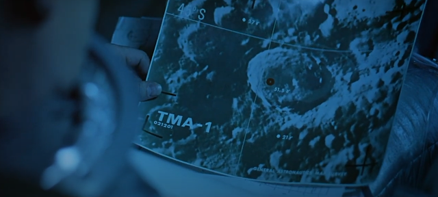
Roger's clue about 'looking within the Moon' starts to sound like the main early plot point in the 2001 movie - the pursuit of the "Tycho Magnetic Anomaly (TMA)":
But our final vista may not end up as grand ...


Comments
Post a Comment