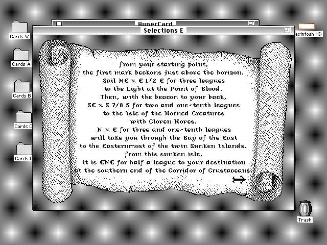
Corridor of Crustaceans
We should take a moment to appreciate the 26's in the last clue - the birthday celebrations must be quite something at chez Allen.
We have the time - 23:33:34 GMT on 23 September 1987, and we need to find where Vega was directly overhead. Turns out, that is one of the simplest things you can look up in the nautical almanac. You: 1) get the Greenwich Hour Angle (GHA) for 'Aries' from the daily table for 23 Sept at 2300 = 347° 15.3'; 2) You get the Sidereal Hour Angle (SHA) and Declination for Vega from the star table for September = 80° 51.2', N 38° 46.4'; and 3) the increment correction for 'Aries' for 33:34 = 8° 24.9'.
The nifty, organizing thing here is that they massively, precisely describe 'Aries', an abstract point in space - and then they can just provide an offset for the 173 actual stars they keep track of. So it can all fit in a little book.
Add 347° 15.3' + 80° 51.2' + 8° 24.9' and you get 76° 32.3' (West, since everything is implicitly measured westerly here - the Brits seemed to be Atlantic-centric when they set this all up). With the North determination in step 2, you get the 8 digit code 38467632.
I quick marched us through the steps here - you do need to go to Dutton's for the full details. And to appreciate how complicated this gets when you try to do something practical with it. Dutton's is a wonderful book that fully embraces the Confucian appreciation for the 'Superior Man' - no patience for Taoist noodling here!
When I put this time and place in Stellarium or Starry Night, Vega is high in the sky, but not at zenith. I think that is because we are so far from 1987, and their calculations have not been tuned for pre-internet times.


Comments
Post a Comment